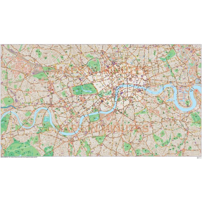
London Large Base map @10,000 scale in Illustrator CS format
Large area London base map giving superb detail and coverage including important buildings and places of interest. Use it as a base map to build your own projects. This London map has been developed to be equally at home in print and screen environments and is licenced for use in web, print, television, film and Apps. Being vector format it is 100% editable so can be easily customised. Includes the Congestion Charge boundaries and fill.
Highly detailed London large area Base Map in Illustrator format
Large scale, up-to-date, detailed, 100% editable layered vector map. Suitable for use from A3 to A1+. London map giving good detail and area coverage including important buildings, places of interest plus Underground and mainline stations. This London map has been developed to be equally at home in print and screen environments and is licenced for use in web, print, television, film and Apps. Being vector format they are 100% editable so they can be easily customised. Available in Illustrator CS.
Formats: Available in Illustrator CS1 (for use with Illustrator CS1 to CS6 or later).
Map dimensions: 34.67" D x 19.37" W (88cm D x 49.2cm W)
Extracted Document sizes: Illustrator CS: 78.8Mb Acrobat PDF: N/A
Licence: Please click on the Licence tab to download and print the licence for this product.
How to download: You will be able to download by logging into Your Account where you can check the status and details of orders (including the applicable Product End User Licence). You can download product purchases for a period of 10 days from date of purchase.
Please note: Product purchases and invoices are downloadable only and are not sent to any postal address
Authors notes: This is a very detailed base map of London with more base information and area coverage than any of our London maps. If you would like a custom map created to your requirements please Contact Us for a quote or give us a call to discuss.
| Licence | Lifelong |
|---|

